
Much of the content on this site is in the form of Portable Document Format (PDF) files for which you need Adobe Reader which is available as a free download with this button.
New: 1957 Daly City Earthquake Archive: In Honor of Manuel G. (“Doc”) Bonilla. This is one of the SeismoArchives located at the Incorporated Research Institutions for Seismology (IRIS) (URL http://www.iris.edu/seismo/quakes/1957dalycity/).
Following is a collection of some of the more significant papers Doc Bonilla wrote in the last forty years. Many of these were reproduced from Doc's original manuscripts typed on an old Selectric and from original illustrations drawn on frosted Mylar with a Rapidograph.
Here is a note from George Schlocker about the first of these papers:
From: “Julius Schlocker” (geoschlock@prodigy.net)
To: “Michael F. Diggles” (mdiggles@usgs.gov)
Dear Mike:
...The [1964] paper was the 3rd and last report Doc Bonilla and I prepared in a great hurry to present to the AEC at a meeting in Washington. It was on the engineering geology of the nuclear reactor site proposed by PG&E at Bodega Bay. As you know we included in it a plan map of the faults and joints we observed in what was called the Shaft, a hole the reactor was to be built in. Doc and I mapped the geology of the hole as it was excavated 24 hour a day. We sometimes observed 20 hours a day and a PG&E geologist gave us data for the hours that we slept. We found a prominent fault we named the “Shaft Fault” that offset black beds of flora on the south wall of the hole and followed it down in Pleistocene sediments for about 90 feet on the wall and on the floor of the hole. So we had three-dimensional geometry of the fault. We also followed it on the surface south of the hole. The excavation reached the underlying granitic rock at night. I was very emotional about seeing that the Shaft Fault in the sediments passed into the granitic rock as a shear zone a foot or so wide. At the final depth we had the workers water-wash the granitic rock floor with a high-pressure hose and we saw an offset by the Shaft Fault of a leucogranite dike.
We had excellent cooperation of PG&E and their construction contractor in mapping the Shaft Fault. The operator of the excavating equipment would halt his digging and put the bulldozer blade where we wanted it so we could see the fault. We were able to map the fault in great detail by measuring from the I-beams at the walls of the hole at various depths.
The paper is a “classic,” I guess, because it may be the first one to show details of faults at a proposed nuclear reactor site. In it we gave some guesses on the possibilities and probabilities of offsets at the reactor site.
Much of the content on this site is in the form of Portable Document Format (PDF) files for which you need Adobe Reader which is available as a free download with this button.
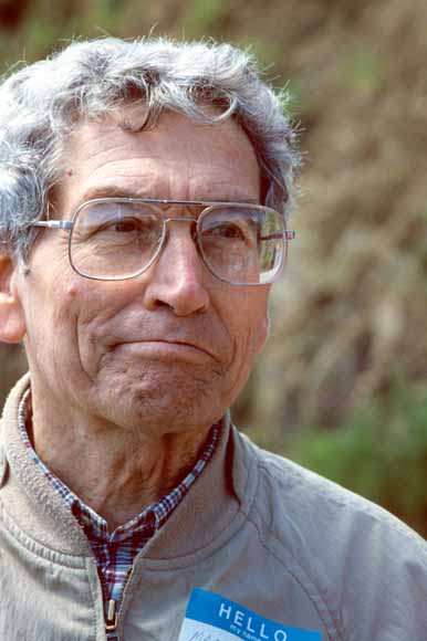
"Doc" Bonilla (Photograph by Mike Diggles, May, 1995)
Schlocker, J., and Bonilla, M.G., 1964, Engineering Geology of the proposed nuclear power plant on Bodega Head, Sonoma County, California: U.S. Geological Survey report prepared for U.S. Atomic Energy Commission, 31 p. (URL http://www.diggles.com/mbonilla/bonilla2/) (three formats: a pair of PDFs - 240 KB, a Microsoft Reader LIT file - 179 KB, and a PalmOS PDB file - 24 KB).
Bonilla, M.G., 1967, Historic Surface Faulting in Continental United States and Adjacent parts of Mexico: U.S. Atomic Energy Commission report TID-24124 (URL www.diggles.com/mbonilla/bonilla.pdf) (PDF: 470 KB).
Bonilla, M.G., and Buchanan, Jane M., 1970, Interim report on worldwide historic surface faulting: U.S. Geological Survey open-file report 1611, 32 p. (URL http://pubs.usgs.gov/of/1970/of1611/).
Bonilla, M.G., 1975, A review of recently active faults in Taiwan: U.S. Geological Survey Open-File Report 75-41, 42 p. (URL http://pubs.usgs.gov/of/1975/of75-41/).
Bonilla, M.G., 1979, Historic surface faulting--map patterns, relation to subsurface faulting, and relation to preexisting faults, in Proceedings of Conference VIII, Analysis of Actual Fault Zones in Bedrock, 1-5 April 1979: U.S. Geological Survey Open-File Report 79-1239, p. 36-65 (URL http://pubs.usgs.gov/of/1979/of79-1239/).
Bonilla, M.G., 1982, Evaluation of potential surface faulting and other tectonic deformation: U.S. Geological Survey Open-File Report 82-732, 58 p.; also U.S. Nuclear Regulatory Commission Report NUREG/CR-2991 (URL http://pubs.usgs.gov/of/1982/of82-732/).
Bonilla, M.G., Mark, R.K., and Lienkaemper, J.J., 1984, Statistical relations among earthquake magnitude, surface rupture length, and surface fault displacement: U.S. Geological Survey Open-File Report 84-256, 37 p., 21 figs. (URL http://pubs.usgs.gov/of/1984/of84-256/).
Bonilla, M.G., 1988, Minimum Earthquake Magnitude Associated with Coseismic Surface Faulting: Bulletin of the Association of Engineering Geologists, Vol. XXV, No. 1, 1988, pp. 17-29 (URL www.diggles.com/mbonilla/bonilla_1988.pdf) (PDF: 130 KB).
Bonilla, M.G., and Lienkaemper, J.J., 1990, Visibility of Fault Strands in Exploratory Trenches and Timing of Rupture Events: Geology, v. 18, p. 153-156, February 1990 (URL http://www.diggles.com/mbonilla/b_and_l_1990.pdf) (PDF: 150 KB).
Bonilla, M.G., 1991, Faulting and seismic activity, in Kiersch, G.A., ed., The heritage of engineering geology; the first hundred years: Boulder, Colorado, Geological Society of America, Centennial Special Volume 3, p. 251-264 (URL http://www.diggles.com/mbonilla/bonilla_1991.pdf) (PDF: 12.2 MB).
Bonilla, M.G., 1999, A Note on Historic and Quaternary Faults in Western Taiwan: U.S. Geological Survey Open-File Report OF 99-447, 5 p. (URL http://pubs.usgs.gov/of/1999/of99-447/).
The URL of this page is http://www.diggles.com/mbonilla/
Date created: March 12, 2003
Last modified: December 6, 2005
Send comments to Mike Diggles at mdiggles@usgs.gov